Coffin Paths, Graveyards and Downley
Have you ever wondered why there is no graveyard in Downley even though the original St James’ church on Commonside was built in 1874?
Over the centuries burials were conducted on hallowed ground that was generally associated with the local parish church. With the ever increasing population, people began to move away from their original village, and began to farm and populate land some distance from the parish church. Eventually their growth in numbers led to demands for a local church to serve the new community. However revenue from burials, together with that from the rites of birth and marriage, was then an important source of income to a parish church and the construction of a new church ran the risk of encroaching upon the territory of the existing parish church and, of greater concern, the loss of revenue to the clergy. The parish church would therefore insist that only a ‘mother’ church could hold burials often necessitating the transportation of the deceased some distance, along what became known as a coffin or corpse paths, to their final resting place.
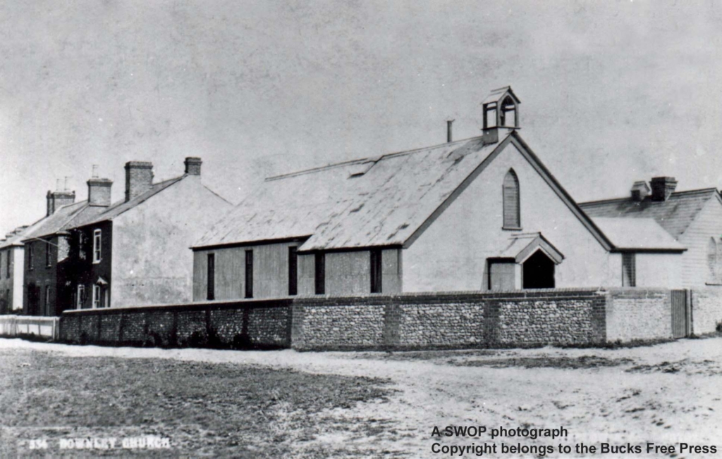
What is now the village of Downley was originally divided between two ecclesiastical parishes with the major part of the village in the parish of West Wycombe, whilst the hamlet of Littleworth lay in the parish of Hughenden. As the village grew St James’ Church was built at the junction of Narrow Road and Commonside to serve the village – but with the exception of burials.
The bodies of those persons from Littleworth, in the parish of Hughenden, would be taken down through the valley from Common Wood, past the Manor House, then onto the graveyard at Hughenden Church, or via Coates Lane and Hughenden Road. The corpse of a poor person would be taken by horse and cart, probably borrowed from the local farmer, or carried by friends.
The last resting place for the Downley people in the parish of West Wycombe was in the graveyard of Saint Lawrence Church- ‘The Church on the Hill’. Their final journey in the old days was made by horse and cart by way of either the Blacksmiths Lane route (opposite the cricket pitch), or Kiln Pond Lane (opposite The High Street) – the paths meeting at the site of the steps (see below). Both routes then followed the path down to The Pedestal at the junction of the Bradenham Road, through to West Wycombe village, and then the long climb around the hill and up to the cemetery. When a person was unable to afford a cart, the route was the same for the people carrying the coffin, but then they would turn right along the Bradenham Road to Flint Hall Farm where a public footpath runs to about halfway up the hill.
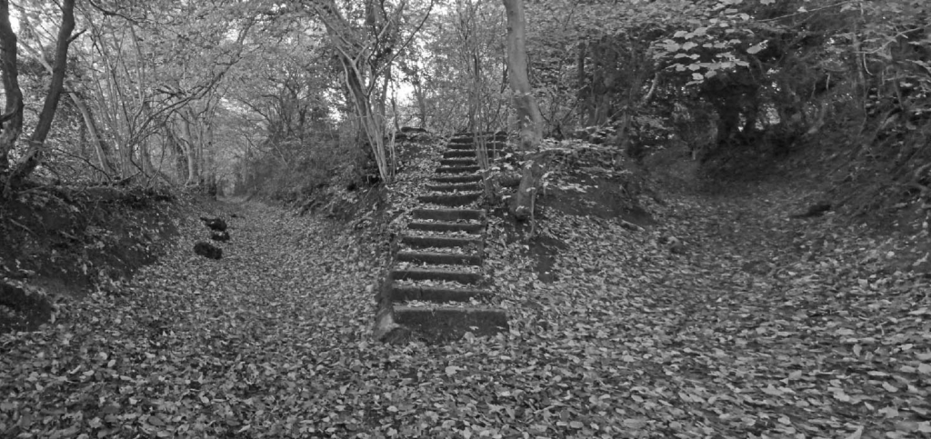
The junction of the two Coffin Paths, with that from Blacksmith Lane (extreme left) and Kiln Pond Lane (extreme right). The sunken nature of both paths, worn down by the passage of feet and livestock, as well erosion by water running off as the adjacent fields, is testament to their antiquity. The current steps, which probably date from the mid -1950s, follow the course of a footpath originally leading to an open field – Three Corner Field. Steps to this field are shown on the map of 1849.
As yet, we have not researched when weddings and christening first took place at St James’ church, either at its original location on Narrow Lane or more recently at the summit of Plomer Hill. Perhaps you can help out with a date and the occasion?